


ZuluHydro — hydraulic modeling for water supply systems
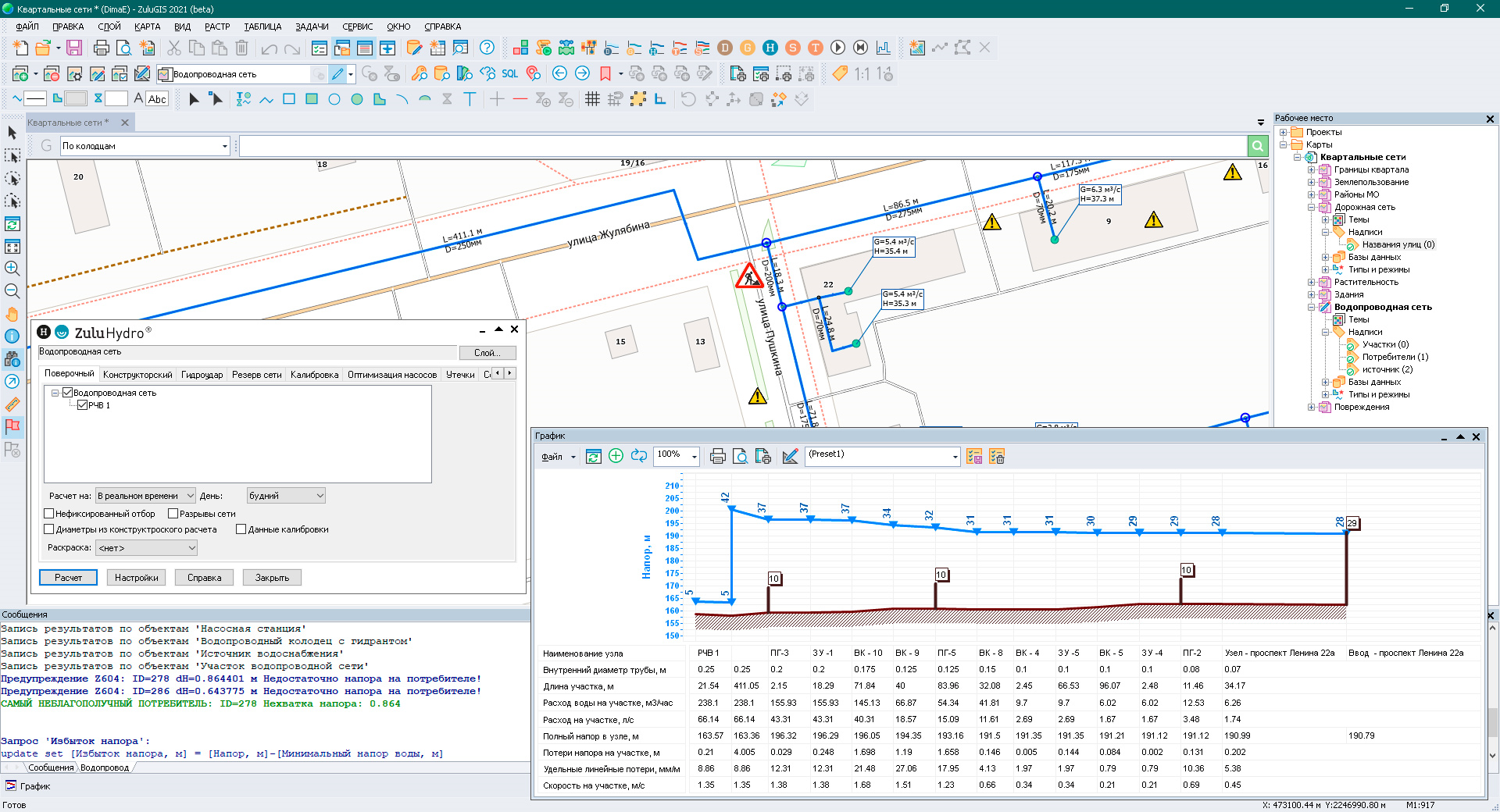
ZuluHydro is a software suit that allows users to analyze, calculate and model water supply networks, and complete various industry-specific tasks. With this set of programs, you can create computational models of networks, complete network certification, use generated models to complete information tasks and topological analysis, and make different hydraulic calculations. ZuluHydro provides the tools for modeling large water supply systems regardless of their complexity. You can model dead-end and circular water supply networks, including those with booster pumping stations and throttling devices, with one or several supply sources
ZULUHYDRO FUNCTIONALITIES:
-
Calculating pipeline diameters for water supply systems
-
Simulation modeling for water supply systems
-
Calibrating water supply systems
-
Calculating reserve capacity for water supply systems
-
Searching for leaks and defects
-
Optimizing pumping equipment
-
Hydraulic shock – finding transient responses
-
Network switching
-
Building piezometric graphs
-
Building a longitudinal profile in (AutoCAD/DXF)
Analysis, calculations, and modeling in ZuluHydro can be closely integrated with a geographic information system (as a GIS extension module) or be part of a separate component library that allows users to complete the abovementioned tasks from their own apps.
There are currently two versions of the product:
- ZuluHydro - analysis and modeling of water supply systems for ZuluGIS
- ZuluNetTools - ActiveX components for utility network modeling
BUILD A WATER SUPPLY SYSTEM MODEL
The geographic information system allows users to create a map of a residential area (city, town, etc.) and map out utility networks.
You can quickly and easily enter a new water supply system into GIS by using a mouse or entering its coordinates. The computational model will be generated immediately. All that is required is setting the calculation parameters for objects and clicking the button to perform the task.
Read more about modeling water supply systems in GIS here.
By using ZuluHydro in conjunction with ZuluGIS, you can design a digital model of a water supply system, which allows you to complete various objectives. Learn more.
See also: Hydraulic modeling for heat networks