


ZuluXTools —ActiveX libraries for software access to Zulu data
ZuluXTools - is an ActiveX component library for developing GIS applications using ZuluGIS maps in popular development environments, such as Borland Delphi, Microsoft Visual Basic, Microsoft Visual C++, Microsoft Access, and others.
ZuluXTools uses ZuluGIS core to work with graphics and semantic data; as a result, a map placed on a form of a new application will look the same as it does in ZuluGIS, which includes its layer settings, semantic data labels and thematic coloring.

- What is ZuluXTools?
- Using ZuluXTools in a rea-life system
- See working apps that demonstrate ZuluXTools functionality on the Developers Page
Below are some of the ActiveX components included in ZuluXTools.
MAP /MapCtrl/
MapCtrl is essentially a map placed on a form. You can specify a path to a completed ZuluGIS map for this component, so that it loads and appears in a component window, or use a plug-in to display one or several Zulu layers..
You can navigate a map, mark or search for objects, process reactions to various events, such as standard mouse and keyboard events as well as isolation of objects or groups of objects, etc.
NAVIGATOR AND EDITOR /MAPNAVCTRL, MAPEDITCTRL/
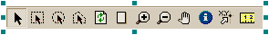
MapNavCtrl is a map navigation toolbar. Connected to the MapCtrl component, it allows you to switch between modes when working with a map – pan, zoom, isolate an object or a group of objects, measure distance, receive information about objects, etc.
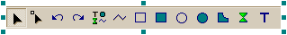
MapEditCtrl is a toolbar for editing map objects. It also works as a plug-in component for MapCtrl and allows you to switch between modes when editing or adding new objects.
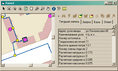
DB BROWSER /ZBSTDBROWSER/
ZbStdBrowser enables ZuluGIS semantic information window on a form. This component can also serve as a plug-in for MapCtrl. If you select an ‘object data’ mode on a map, your browser will display semantic information for every highlighted object in accordance with the connected database.