


ZuluGIS Mobile — our Android app that allows you to work with geodata on ZuluServer

ZuluGIS Mobile enables users to work with data published on ZuluServer – make search queries, display ZuluGIS layer objects on a map, edit graphics and tabular information, send mobile camera images and various documents directly to ZuluServer.
By communicating with a mobile device’s GPS receiver, ZuluGIS Mobile makes it possible to display speed and current position, save information about device location in real time on the device itself or to a ZuluServer layer. You can add data from tile servers (OpenStreetMap), WMS maps, SQLiteDB and MBTiles offline maps, GPX tracks and ZuluServer layers as map layers on ZuluGIS Mobile.
You need a ZuluServer 8.0 Web Services license in order to use ZuluGIS Mobile and ZuluServer.
DATA MANAGEMENT WITH ZULUGIS MOBILE
Data stored in ZuluGIS Mobile is organized by layers. The system works with the following types of layers:
- Tile layers
- SQLiteDB, MBTiles
- WMS layers
- ZuluServer layers
- Tracking layers
Learn more >>
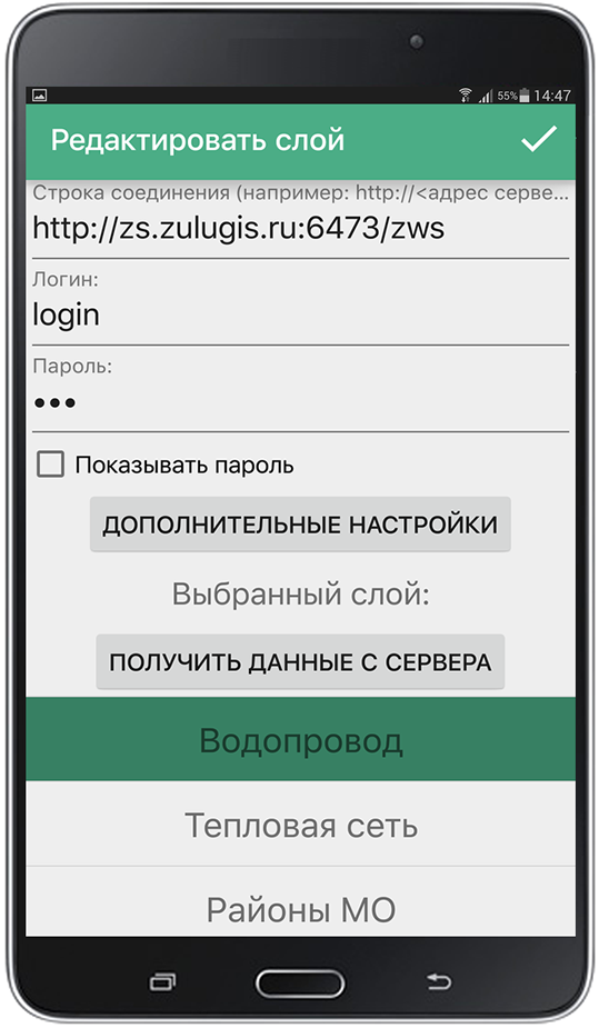
ZULUSERVER LAYERS
ZuluServer data is accessed using ZWS (Zulu Web Service) protocol. The data should be prepared to work with ZuluServer Web Services.
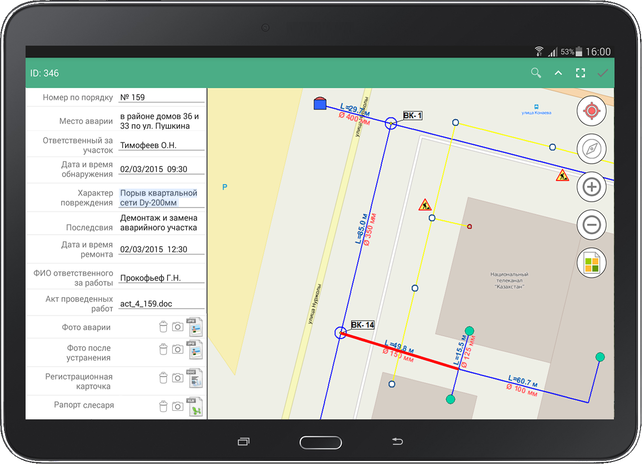
Some of the tasks you can perform using ZuluServer layers are: receive tabular and graphics data, edit tabular information, modify and add graphics objects ZuluGIS desktop tools for visualizing data, such as directions, thematic coloring and labels, are also available for the mobile version.
Learn more >>
NAVIGATION

The GLONASS/GPS satellite navigation module on your mobile device allows you to determine your location on a map and record tracks – routes.
Tracks can be saved as GPX files on the device or recorded in real time to Zulu tracking layers. Tracks and routes from all mobile devices can be recorded to a singular ZuluServer layer.
Important! If the device does not have access to or is blocked from accessing Google Services API, then it is not possible to receive location updates in ZuluMobile.
EDITOR
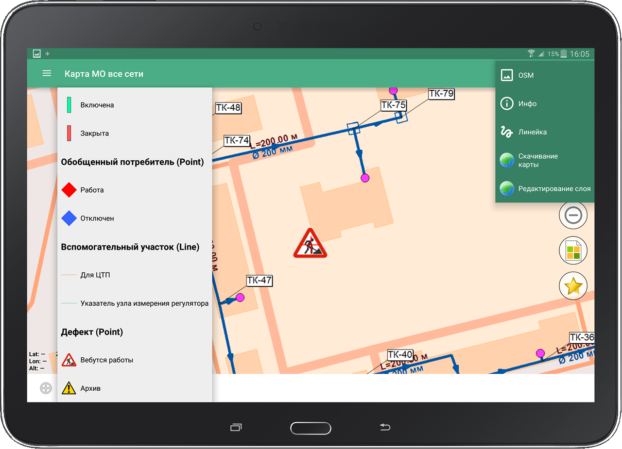
ZuluGIS Mobile is equipped with a graphics editor for ZuluGIS standard objects. The system allows users to install and edit objects entered on a map, such as failures, outages, POI and so on.
The editing tool supports linear-nodal links, which makes it possible to draw topologically connected networks.
ZuluGIS Mobile does not let users create new layers and configure their structures; instead, you can edit layers that have been created and published on ZuluServer in advance.
The graphics editor can work offline when the mobile internet is unavailable. When you connect to the Internet, all created objects, completed attributes and uploaded documents are automatically uploaded to a ZuluServer layer.
ACCESSING AND PROCESSING INFORMATION
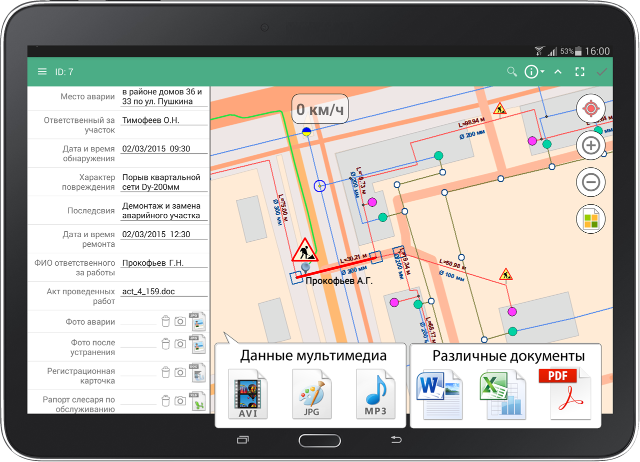
Users view and edit object-related information on the Internet. With ZuluGIS Mobile, you can work with tables, text documents, graphics, video and audio files located on the company’s webserver.
Therefore, it is possible to fill in information in tables, upload various documents, search for objects in databases and select items by criteria directly on site.
WORK MODES

- online – all information is stored on a company’s server or GIS portal. Users can access up-to-date graphics and tabular data from the Internet in real time.
- offline –completely autonomous, all information is stored in raster format on the memory card of a mobile device.
- Hybrid mode – some information is stored on the memory card of a mobile device, while the rest can be accessed online from a company’s webserver or GIS portal.
AUTHORIZED ACCESS
ZuluGIS Mobile allows users to control and restrict access to data. You can configure security policy settings, establish a wide range of rules and rights for accessing ZuluServer layers.
See also: View and edit GIS data in browser