Digitalization of urban spaces, territory assignment scheme
Georgy Vladimirovich Ilyin
Sole proprietor
Moscow
[email protected]
Hello!
Today, many municipalities do not fully know their services and facilities. How much to clean sidewalks, repair roads, mow lawns, empty waste containers, or paint benches in a particular settlement or building's adjacent area is a rather empirical question which defies exact maths.
Our ZuluGIS setup and many years of experience working under municipal contracts in the Moscow region have shown that the digitalization of urban spaces in order to obtain accurate, even certified data for each land lot is no longer a matter of the future but of the present. That is, territory assignment schemes and certificates for buildings' adjacent areas, in short, the inventories of municipal facilities are no longer created in the same way as in the film "Office Romance".
How do we do it? First, we vectorize the space. The Zulu platform provides quite convenient tools for inserting orthoimages (aerial photographs) and connecting precision geodetic devices (GNSS receivers), which help to populate the Current Municipality Area layer with polygons whose cards accumulate data about the type, coverage, area, state, and any other information that the client would like to collect and store. Zulu allows you to add line objects that store data about curbs, fences, and utility networks, and point objects that visualize street furniture, benches, bins, containers, monuments, and anything else on the map using symbol icons.


Examples of street furniture


Maximum zoom-in but allows you to zoom in even more for more detail
Having completed this herculean task, we begin the most interesting (and the most useful) part of work for the client – delineating areas of responsibility for each site. Apartment buildings that have a housing management company receive sections of the territory for their maintenance according to the laws and regulations of the municipality. This is done using the building flag in the land lot card. The color-coded theme (by housing management company) activated by the button in the ZuluGIS interface colors the map in different colors, visualizing the cleaning and maintenance areas of every owner of city buildings and territories. The Rosreestr layer with cadastral plots imported from the State Database (if the building has any) allows you to control the accuracy of assigned land lots.

Vectorization results

After assigning territories to houses and entering information
The outcomes of all the work done are the so-called Itemized lists of urban facilities, which, as we said at the beginning of the article, those who have not thought about digitizing their territories can only dream of. The lists are tables with quantitative characteristics of ALL urban facilities – the clients know exactly how many sidewalks, lawns, waste containers, and benches they have, how much of all this they personally clean using municipal services and how much is done by any of the housing management companies, how much and what exactly is assigned to a store, building, housing management company or a separate legal entity from the municipal team.

Example of summary information on building adjacent areas
This result is best illustrated by the module built into the ZuluGIS environment, which has been developed by us and allows you to see and understand the municipal facilities and services clearly, which was impossible to do previously; it is provided directly to potential customers.
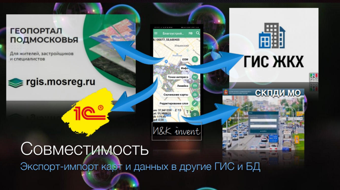
Of course, like any other full-fledged geographic information system, ZuluGIS has all means of communication with other "colleagues"; that is, it is possible to export and import spatial data to departmental and regional GIS. We also have such experience.
Video: Module "Itemized lists for ZuluGIS 2021 for inventorying urban spaces, territory assignment scheme, certificate for building's adjacent area"